Mobile LiDAR for Railways: How a Single Survey Pass Builds Your Complete Corridor Digital Twin
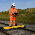
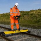
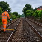
Mobile LiDAR scanning transforms railway asset management — delivering a survey-accurate 3D corridor model, clearance analysis, vegetation mapping, and complete asset inventory from one survey pass. Here’s how it works and why railways are adopting it across Canada, USA, Brazil and Australia.